Writer
Katherine Foran-
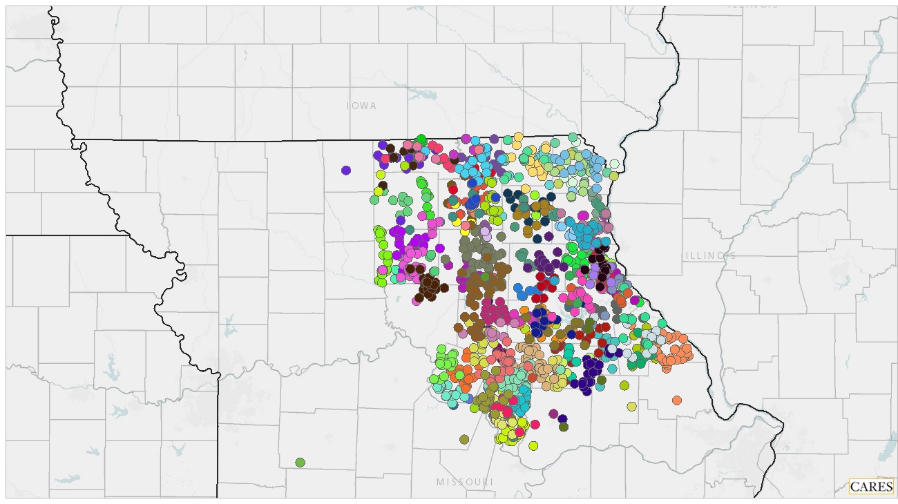
 This screenshot shows how individual 4-H enrollments can be plotted on an interactive CARES map. Other map filters can be added to help guide program decisions.
You can live and work somewhere your whole life and still not really know it, says Katie Hogan, a 4-H youth development specialist in MU Extension’s Northeast Region.
That is why Hogan launched the Getting To Know Your County training with her team of youth development specialists and youth program associates the region.
During an online session in December, Hogan guided 10 team members through a step-by-step information-gathering process. Along with two of the region’s extension engagement specialists, they compiled data and information from local sources, as well as from the All Things Missouri mapping tool.
For each of the 10 counties, team members used worksheets to track all the local resources, including:
- Schools.
- Community groups and events.
- Community leaders and influencers.
- Businesses.
- Media connections.
- Meeting places and contacts.
- 4-H info: events, assets, kinds of programs and projects, enrollment by clubs/type by geographical area.
- Community volunteer assets.
The maps, which will be updated annually, are accessible to faculty and staff through the region’s shared Teams files.
With the help of MU Center for Applied Research and Engagement Systems Assistant Director Jamie Kleinsorge, the Northeast Region team learned how to use All Things Missouri demographic data to create a detailed picture of local racial and ethnic representation, poverty levels, free and reduced lunch participation and more. The Missouri Map Room also allows users to pull together maps of enrollment data specific to each county’s 4-H programs.
“The goal was to build data maps that put local information of every kind at every 4-H team members’ fingertips,” Hogan said. “This information will help us use real data to guide future growth, volunteer recruitment and delivery needs.”
Hogan credits Missouri 4-H Director Lupita Fabregas with inspiring the asset-mapping model through a leadership exercise Hogan participated in several years ago.
Specialists in other program areas can use this information to target potential audiences, needs and locations for their programs. Office managers can use the maps to find suitable and affordable locations for local extension programming.
“I think the Getting To Know Your County exercise can be a simple, valuable tool for other regions and program areas to use, as well, as we work to grow and adapt our programming to achieve our mission of serving Missouri and delivering Mizzou,” Hogan said.
For more information about the Getting To Know Your County process, MU Extension faculty and staff can contact Katie Hogan at hoganka@missouri.edu.
For questions about All Things Missouri and data mapping, contact Jamie Kleinsorge at kleinsorgej@missouri.edu.